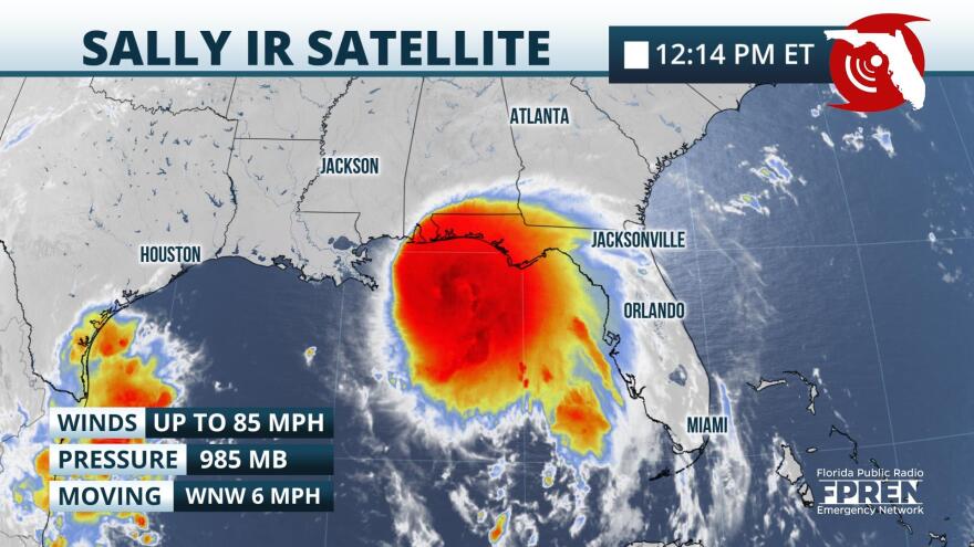
Sally, which soaked much of South Florida this weekend, is now set to bring tropical storm force conditions and torrential rain to the Panhandle coastline starting Monday afternoon.
Sally intensified into a Category 1 hurricane as of the National Hurricane Center’s late morning update on Monday. Maximum sustained winds were near 90 mph. It is moving slowly toward the west-northwest at 7 mph. Rain bands from the storm were moving ashore Monday morning, but tropical storm force winds are not expected until late Monday afternoon or Monday evening. Tropical Storm Warnings were in effect from west of St. George Island westward to the Pensacola area. A Tropical Storm Watch remains in effect for the Franklin county coastline, where tropical storm force winds are possible but not as likely as areas farther west.

Sally is forecast to strengthen further and possibly become a Category 2 hurricane as it moves in the general direction of the Gulf coast in southeastern Louisiana, Mississippi, and Alabama. Landfall is expected some time on Tuesday, but Sally’s slow movement means squally weather is likely to continue Wednesday and Thursday over the Florida Panhandle.
Storm Surge Warnings are in effect for a large portion of the Alabama, Mississippi, and southeast Louisiana coastlines, where several feet of surge are likely. The official surge forecast from the National Hurricane Center is projecting 1 to 3 feet of water above normally dry ground, particularly near Escambia Bay and near the Apalachicola and St. Marks River areas. Other areas of generally minor coastal flooding are expected near the time of high tides, and for that reason, the National Weather Service issued Coastal Flood Advisories for much of the Panhandle and Big Bend coastline. High surf and dangerous rip currents are expected to pose a danger to swimmers, as well.
Rainfall amounts of 6 to 12 inches are anticipated along the coast from Apalachicola and westward through Thursday. Amounts of 2 to 5 inches are possible as far east as Marianna and Tallahassee. Flash Flood Watches are in effect, mainly from the Apalachicola River westward, including Marianna, Panama City, and Pensacola. Widespread flash flooding is possible, especially in the watch area.

NOAA’s Storm Prediction Center said a couple of tornadoes may occur after sunset Monday through Wednesday over the Florida Panhandle associated with Sally’s rainbands.
Sally is expected to merge with a cold front and move off the Carolina coast on Friday. Drier air is likely over the Panhandle this weekend, but the cold front may produce areas of rain over the Florida peninsula this weekend even after Sally’s departure.
Copyright 2020 WUFT 89.1


