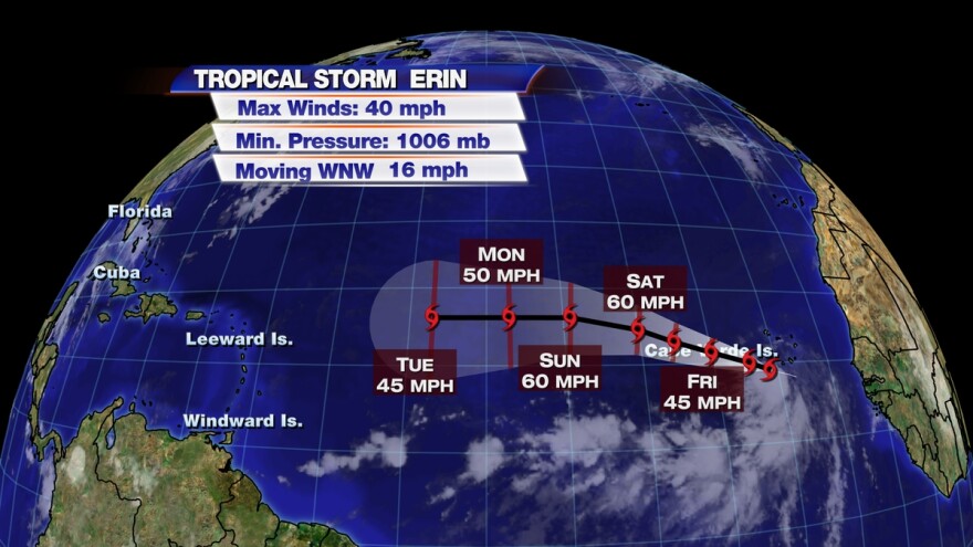
Tropical Storm Erin is likely to strengthen over the next day or so, but then potentially weaken as it traverses some cooler water and drier air over the central Atlantic. Similar to Tropical Storm Dorian, the system may even dissipate entirely by early next week when it moves through this more hostile environment. Regardless, it would take more than a week for Erin to move across the Atlantic and pose a real threat to any land areas.
INVEST 92L
The area of disturbed weather in the western Caribbean that we have been tracking for several days is moving ashore near the Yucatan Peninsula as nothing more than a disorganized tropical wave. Because of this, the hurricane hunter flights were canceled today by the National Hurricane Center. When Invest 92L moves back over the warm waters of the southwestern Gulf of Mexico on Friday, the NHC still gives it a high chance of development into a depression or Tropical Storm. Forecast data suggests, given a weaker system, it would more likely take a northwest track and pose a potential threat to Texas of Louisiana late in the coming weekend.
Regardless of tropical storm formation or track, much of the state will likely receive some heavy rainfall Friday or Saturday due to the northward surge in tropical moisture. At this time, forecast data suggests that the heaviest rain will fall in the panhandle and across portions of North Florida where this tropical moisture (and possible storm) will interact with a weakening or stalling cold front. While the recent drying trend has likely mitigated a widespread flooding threat, localized flooding would certainly be possible where slow-moving and repeating showers and thunderstorms form.


